Building date: 1840's, demolished 1960's.
Original use: Smokehouse
Corner structures:
Mortar application and content:
Types and uses of stones:
Types and choice of windows:
Structures with similar masonry details:
Masons who worked on building:
Unique features:
Map views courtesy Google Maps street level view. The provided name is that of a previous owner. Address is Google Earth confirmed; 43°14'12.66"N 78°15'12.15"W. Current owner is Sheffer 2021 Tax Roll. Known information to-date suggests the location and acreage of the property, but the exact location of the smokehouse on the property is unknown.
Town of Albion and Orleans County Maps
1860 Niagara Orleans Counties Alb-10 Excerpt Map.jpg ¹1913 Century Atlas shows F. Johns "Maple Lawn" farm with house and barns very tight to and just north of the Eagle Harbor train station. These are oddly absent from the older map shown. They are in the southwest corner of Holland Company Lot 26 Township 15 Range 2. In the same atlas Pages 108-9 Fred Johns of Knowlesville RFD #2 describes the 70 acres farm. He says that "William Mosher" purchased the land from the Holland Land Company and that "Mr. Johns" acquired it in 1896. Contributor Gerard Morrisey.

Before it was torn down in the 1960's, this 1840's smokehouse stood on the Hartley Johns property on the east side of Eagle Harbor-West Barre Road, near the Depot south of Eagle Harbor. "Chapter III Cobblestone Buildings", by Delia Robinson, "Architecture Destroyed in Orleans County, New York", by C. W. Lattin, Orleans County Historian, November 1984. Published by the Cobblestone Society.
The Livingston Republican, Geneseo, N.Y. 9/16/1948. Editor's Note: Million Dollar Highway is current day Highway 31.

"Out of the Past, Old-Fashioned Smoke Houses", by Cary H. Lattin, [Former] County Historian, Orleans County, N. Y., Member Cobblestone Society, Albion N. Y.
 Alb-10 Smokehouse 2.jpg ¹ |  Alb-10 Smokehouse 3.jpg ¹ 1963 | 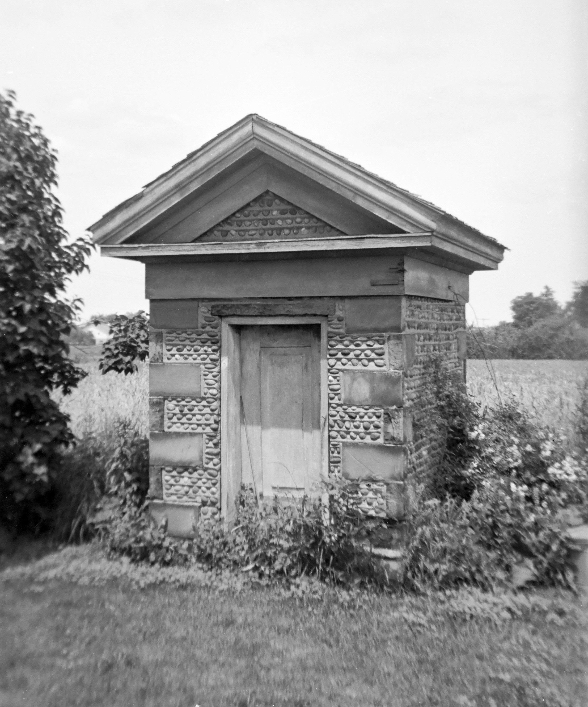 Alb-10 Smokehouse 1.jpg ¹, ² |
² "A very Fine Example of Greek Revival architecture in the cobblestone construction built in 1840's on Hartley Johns Farm at Eagle Harbor Station, Orleans County." Photograph caption in the article "Out of the Past, Old-Fashioned Smoke Houses", page 32, by Cary H. Lattin, County Historian, Orleans County, N.Y.
